Map and Directions
Address
Address: 1 Blue Heron Lane, Eureka Springs, Arkansas 72631
Phone: (888) 762-7158
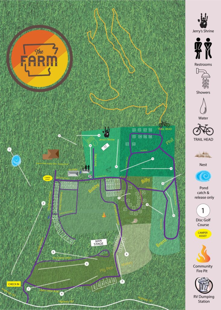
Campground Map
Directions
Coming from St. Louis – 4.5 hours – take 44 West to US-65 South (exit 82A near Springfield, MO). Take US-65 South toward Branson, until you reach Highway 62 West. Take 62 West towards Eureka Springs. Go through Eureka Springs and continue on Highway 62 West for 9 miles until you reach 187 North. Turn right on 187 North. Follow that for 2 miles. Turn left on to Blue Heron Lane.
Coming from Kansas City – 3.5 hours – take HWY 49 South until you hit 44 West. Take 44 West for about 10 miles and then get back on 49 South. Take 49 south to 62 East (in Rogers, AR). Take 62 East for about 40 miles towards Eureka Springs. Turn left on 187 North. Follow that for 2 miles. Turn left on to Blue Heron Lane.
Coming from Little Rock – 3.5 hours – Take HWY 40 West until you hit 49 North (Near Fort Smith, AR) Take 49 North to 62 East (in Rogers, AR). Take 62 East for about 40 miles towards Eureka Springs. Turn left on 187 North. Follow that for 2 miles. Turn left on to Blue Heron Lane.
Coming from Tulsa – 2.25 hours – Take 412 East until you hit 49 North (near Springdale, AR). Take 49 North to 62 East (in Rogers, AR). Take 62 East for about 40 miles towards Eureka Springs. Turn left on 187 North. Follow that for 2 miles. Turn left on to Blue Heron Lane.
Coming from Dallas – 5.5 hours – Take 75 North, until you hit 69 North. Take 69 North to 40 East. Take 40 East to 49 North (near Fort Smith, AR). Take 49 North to 62 East (in Rogers, AR). Take 62 East for about 40 miles towards Eureka Springs. Turn left on 187 North. Follow that for 2 miles. Turn left on to Blue Heron Lane.